Council narrows down district map submissions

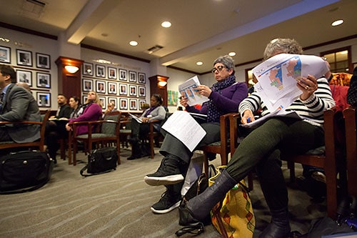
And then there were six. The Claremont City Council whittled down the number of district maps to six finalists during a special meeting Monday night, the third such event to take public comment on the city’s transition to district-based elections.
Doug Johnson of National Demographics Corporation (NDC) said the 13 finalists were taken from 31 maps selected—a high number of submissions for a city of Claremont’s size, he said. Three of the maps—maps 123, 124 and 125—were submitted from NDC to round out the available options, he added.
“Tonight it gets interesting,” Mr. Johnson said. “We actually have the maps to go through.”
The map eventually chosen by the council will represent the five council districts in the 2020 election. After that, the lines will be re-drawn with new census data for the 2022 election.
The council passed a resolution of intent in November 2018 to explore moving to by-district elections after the city claims it received “oral communication” in September from the Southwest Voter Registration Education Project (SVREP). City Attorney Joseph Larsen indicated the group would send a demand letter to the city after the 2018 election claiming it was in violation of the California Voting Rights Act (CVRA).
Mr. Larsen revealed the existence of that oral communication at Monday’s meeting. As of yet, no formal demand letter has been received by the city.
Texas-based SVREP, which has a regional office in Los Angeles, did not respond to multiple requests for comment.
Councilmember Ed Reece asked Mr. Johnson and Alan Fenstermacher of Rutan and Tucker what would happen if the city were to wait until after the 2020 census data comes in.
The city is in an “interesting” situation, where they’re moving forward without a demand letter, Mr. Fenstermacher said. Once it adopted the resolution, it would not be liable to pay up to $30,000 in attorney fees, if a demand letter was sent.
But the longer the council waits, he claimed, the higher the risk is of getting a demand letter from an attorney. Mr. Johnson noted that SVREP is responsible for 70 letters sent to California cities thus far.
“If they called you, they’re going to send a letter,” he said. “There’s no way out of it.”
The maps presented took different approaches to how Claremont’s population would be districted. Of particular interest was how to group south Claremont, which has the highest concentration of Latino citizens.
Some maps, such as map 116, created one large district in south Claremont, starting at the railroad tracks in the north and ending at the southern border with Pomona. Other maps split the area in half, with map 114 grouping south Claremont with part of the Village. Map 101 split up the region into four districts.
The key to a good map is to prevent vote dilution, where a certain “protected group,” such as Latinos, is split so many times that their voting power gets canceled out, Mr. Fenstermacher told the council. All the maps presented on Monday passed that requirement.
The maps took different approaches to the Colleges, where there is a large concentration of students in dorms but much lower voter turnout. Map 104, for example, grouped the entire Colleges (save for Keck Graduate Institute) into one large district, while map 123 managed to have all districts responsible for at least one college.
During public comment, resident Marc Merritt was worried that districting would lead to one “whack job” running unopposed for a council seat in one district, or nobody running in a district at all.
“It’s not that easy to find good candidates for city council,” he said.
Lynne Marsenich disagreed, noting there’s a larger interest in democracy within Claremont, especially after the last few elections.
“More districts encourage more people to run to represent their constituency, and I think that will happen in Claremont as well,” she said.
Mr. Fenstermacher said that if nobody were to run in a certain district’s election, the council would appoint someone from that district.
Jim Belna urged the council to scrap the process altogether, keeping the city at-large until the city receives a demand letter, which he felt would not happen. Other cities have resisted the change until a letter was sent, he said.
“We can easily afford to do like all of our neighboring cities, and wait to see if we ever receive a demand letter before we turn our entire political system upside down,” he said.
Bob Gerecke advocated for treating south Claremont “as a protected class,” and liked map 114.
Rachel Forester advocated for a “diversity of zoning” in each district—where each councilmember would have different types of residential and commercial zones within their district.
Betty Crocker noted she drew map 115, which kept south Claremont in one district. She was concerned if the area were to be divided or grouped with the Village, the district “would be weighted more towards the Village than in south Claremont.”
She also expressed disappointment the previous council decided to move forward on a verbal threat from the SVREP.
“I would expect more disclosure as we move forward,” she said. “This is very serious.”
Each councilmember was tasked with choosing their preferred maps for further discussion.
Councilmember Jed Leano said he chose his maps based on equal participation and voter turnout. Map 123 was, as he called it, the “undisputed, undefeated heavyweight champ of the world.”
“Under map 123, every district is turning out approximately 3,000 voters,” he said. “There is nothing that comes close to the level of equal participation.”
Mayor Pro Tem Larry Schroeder emphasized that even if districts would separate future councilmembers, they would still care for the whole community.
“I don’t think people are going to be so myopic they are going to build walls around these districts,” he said.
He chose maps 110, 115 and 125, in an effort to keep south Claremont and the Village in separate districts, thereby giving each distinct neighborhood individual representation on the council.
Councilmember Jennifer Stark liked both maps 114 and 107—114 because it equally split south Claremont offering a chance for greater representation and to allow the neighborhood to get closer to having a majority on the council. She also liked map 107, because it split up Pilgrim Place into multiple districts, which fulfilled a previous request by the community’s residents to be divided.
In the end, Ms. Stark chose map 114, with a request to slightly alter the Pilgrim Place area so the campus is divided into two districts.
Mr. Reece preferred maps 110, 123 and especially 124 because it splits up Pilgrim Place. He did offer a couple of small changes to map 124—moving one district into the future Village South location and another district into the eastern end of the Village.
Mayor Corey Calaycay lamented the process, saying that if there were instances of voter disenfranchisement, Claremonters would have already made it known.
“I think that’s perhaps the most disheartening part about this, that it is being forced upon us,” he said.
He decided not to weigh in saying he didn’t want to make the process more complicated than it needs to be.
“At this point I’m more interested in what the new folks have to say, so I want to make sure we’ve incorporated them,” Mr. Calaycay said. “They’re the most important folks right now.”
The six chosen for the next meeting were maps 110, 114, 115, 123, 124 and 125. The maps are all available on the city’s website at claremontca.org/districting.
Public workshops, where residents can provide input on the maps and the sequence of elections, will take place Saturday, February 9 at 11 a.m. at the Youth Activity Center and again at 2 p.m. at Claremont Place Senior Living.
At another public hearing at 6:30 p.m. on Tuesday, February 12, city staff will introduce an ordinance to the council.
—Matthew Bramlett
news@claremont-courier.com


0 Comments