Police issue evacuation order for Mt. Baldy, more photos

Photo of the Bridge Fire taken at 4:30 p.m. Monday from the Padua Hills neighborhood of Claremont. Photo/by Catherine McIntosh
by Mick Rhodes | editor@claremont-courier.com
San Bernardino County Sheriff’s Department officials ordered the evacuation of all residents north of the San Antonio Dam up to Mt. Baldy Resort late Monday afternoon after the Bridge Fire more than doubled in size in a matter of hours, going from 1,225 acres at 1 p.m. to 2,995 acres by 7:30. The blaze remains 0% contained, with high temperatures and strong winds continuing to aid in its expansion.
Monday evening’s Mt. Baldy evacuation order follows those implemented Sunday above Azusa in the East Fork communities of Camp Williams Resort, including the cafe, mobile home park, and campground, and River Community, which is near the resort.
Interviewed at 1 p.m. Monday, Angeles National Forest Public Affairs Officer Dana Dierkes said structures in north Claremont and the unincorporated area in the northwest of town were not in danger. “This fire is currently pretty far removed from the Claremont area,” Dierkes said at the time. “The fire is above Azusa at this point in time.” It was unclear if the Mt. Baldy evacuation order later in the day meant the threat to the Claremont area had changed, or that structures in Mt. Baldy were in immediate danger. Dierkes had not yet returned emails texts asking for clarification at 9 p.m. Monday.
No loss of life, injuries, or loss of property due to the fire has been reported thus far.
There were 250 firefighters on the scene by Monday evening, up from 150 earlier in the day, including local crews from Angeles National Forest and LA County, California Highway Patrol, LA County Sheriff’s Department, and four USFS helicopters and four fixed wing aircraft dropping water and fire retardant on the blaze.
As of 1 p.m. Monday the west end of the fire was being held at Shoemaker Canyon Road and the south at Glendora Mountain Road above Azusa. Dierkes said at the time there was no imminent danger to structures in that area either.
The air quality index was an unhealthy 187 in Claremont at 2 p.m. Monday, according to airnow.gov.
Claremont Unified School District issued an update on air quality and school safety measures Monday evening, which read in part, “Due to the current air quality and smoke, all outdoor activities, including PE and recess, will continue to be held indoors tomorrow [Tuesday]. These adjustments are part of our ongoing efforts to minimize exposure to unhealthy air conditions and keep your children safe at school.”
For the latest updates on the fire, go to inciweb.wildfire.gov/incident-information/caanf-bridge-fire. Additional information, including some dramatic video, is posted on the Angeles National Forest Facebook page at facebook.com/angelesnationalforest.
“Overnight the fire behavior was extremely active, moving south to Glendora Mountain Road,” Dierkes said at 1 p.m. Monday, adding she didn’t have any new information as to which direction the blaze was currently headed.
The local mountains received some sporadic rain Sunday afternoon, but those squalls did not reach the Bridge Fire site, Dierkes said.
San Gabriel Canyon and the East Fork of the San Gabriel River remain closed to all visitors. Road closures include Highway 39, East Fork Road, Glendora Ridge Road, and Glendora Mountain Road.
The cause of the fire is under investigation.
“If you’re coming to visit the Angeles National Forest, please remember that our fire danger level is high,” Dierkes said. “It’s really important to know before you go; always check fire restrictions for each visit, as restrictions can change at any time with little to no notice.” For the latest updates, go to the Angeles National Forest’s fire danger page is at fs.usda.gov/detail/angeles.
This story will be updated as new information is made available.
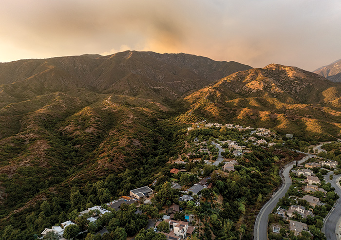
Padua Hills was not in danger as the Bridge Fire burned high up the other side of the mountain to the north. Courier photo/Peter Weinberger
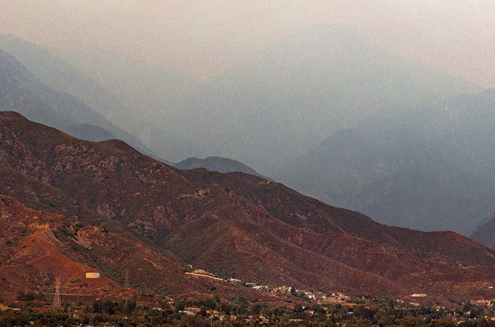
The outline of Ontario Peak and Mt. Baldy, center, can barely be seen as an outline through the Bridge fire smoke Monday evening. Courier photo/Peter Weinberger
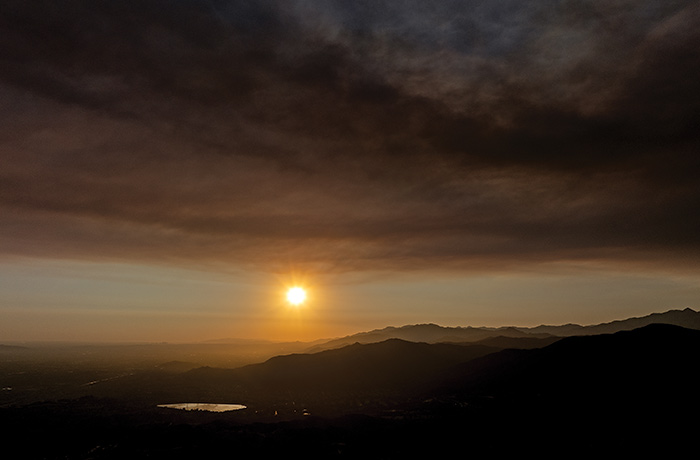
Heavy smoke from the Bridge fire drifted west of Claremont just before sunset. Courier photo/Peter Weinberger
1 Comment
Submit a Comment
You must be logged in to post a comment.


Lots of useful info here. Thanks!