

Cruising over Los Angeles at 2700 feet

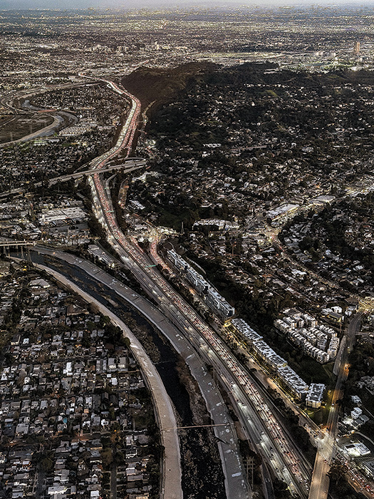
Commuters pack the 110 Freeway through downtown Los Angeles as the lights of Dodger Stadium glow in the upper left.
The Courier took off from Cable Airport in Upland this week for a single-engine plane ride to the Pacific Ocean and back. We looped past the Santa Monica Pier, weaving through a maze of air traffic — planes, helicopters, and even drones — to capture this bird’s-eye view of the Los Angeles basin. Courier photos/Peter Weinberger
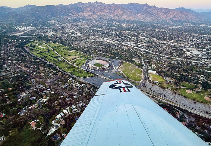
We made a tight turn in Pasadena as the plane hovered around the Rose Bowl just before sunset.
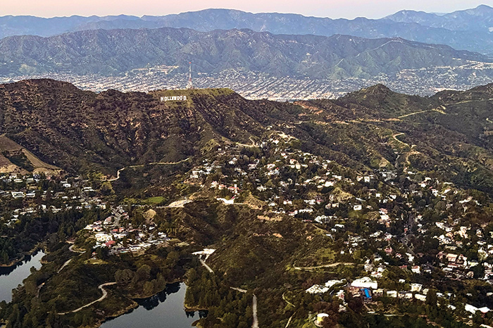
Most ground views of the Hollywood sign mask the true layout of the terrain to the south. Mount Lee, on which the sign sits, also hides the mass of humanity to the north.
One of the busiest roads in the U.S. is the 5 Freeway heading south into Orange County. The amount of traffic commuters deal with is stunning from the air.


0 Comments