Winds ease, but fires remain active in Altadena, Palisades; Death toll reaches 25
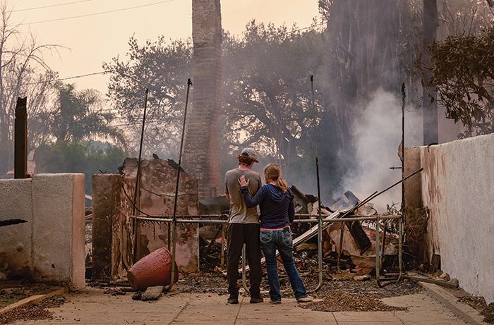
A couple survey the smoking remains of their La Paz Road home in Altadena at 2:15 p.m. January 8, hours after the Eaton Fire, driven by hurricane force winds, swept through their neighborhood. Photo/by Jhovany Quiroz
by Mick Rhodes | editor@claremont-courier.com
The dangerously high winds predicted for Tuesday and Wednesday were milder than expected, giving firefighters and residents a much needed bit of good news in Altadena and Pacific Palisades, though fire danger in those areas remains critical.
At press time Thursday the death toll from the wildfires had risen to 25, the Palisades Fire had burned 23,713 acres and was 22% contained, and the Eaton Fire in Altadena had consumed 14,117 acres and was at 55% containment.
Hurricane-force winds up to 90 mph drove fast-moving firestorms through Pacific Palisades, Altadena, Sylmar, Hollywood, and other Southern California communities January 7 and 8. The fires have since destroyed more than 12,000 structures, among them national landmarks and hundreds of local and regional treasures, and all told have burned more than 60 square miles. A 6 p.m. to 6 a.m. curfew remains in effect in the fire zones of Altadena and Pacific Palisades.
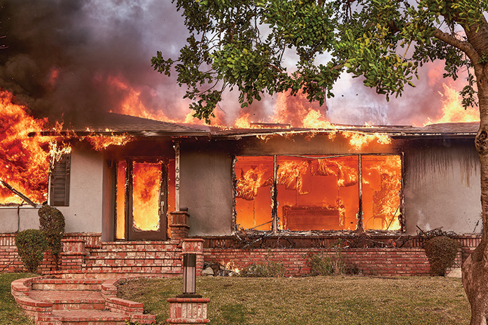
Firefighters were unable to save this fully engulfed home in the 1600 block of Midwick Drive in Altadena on January 8. The photo was taken at 2:39 p.m. Photo/by Jhovany Quiroz
Some 88,000 people remained under evacuation orders at press time. That figure had been at more than 200,000 at the fires’ peak on January 8. More than 62,200 Southern California Edison customers remained without power.
The Eaton Fire is the second most destructive in California history in terms of structures destroyed, at roughly 7,000. The 5,000 structures lost in the Palisades Fire put it in fourth place on the grim list. The 2018 Camp Fire consumed 18,804 structures and killed 85 people, ranking it number one in both of those categories. The LNU Lightning Complex Fire of 2020 is the most destructive fire in the state in size, at 363,220 acres.
Estimates of fire-related property losses in Southern California have varied wildly, from $30 billion to $150 billion. That number is sure to fluctuate — likely upward — in the weeks ahead as the scope of the damage is more accurately quantified.
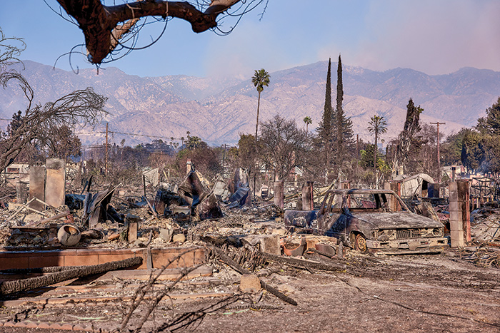
An entire Altadena neighborhood on Harriet Street between Olive and Lincoln avenues lies flattened in this photo from January 9. Photo/by Jhovany Quiroz
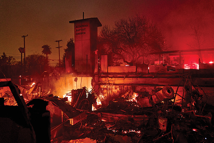
What remains of Altadena Baptist Church, 791 E. Calaveras St., Altadena, continues to burn at 5:50 p.m. January 8 Photo/by Jhovany Quiroz
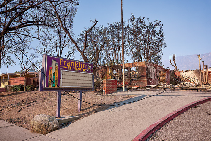
Altadena’s Franklin Elementary School, which closed in 2020, was destroyed by the Eaton Fire. Photo/by Jhovany Quiroz
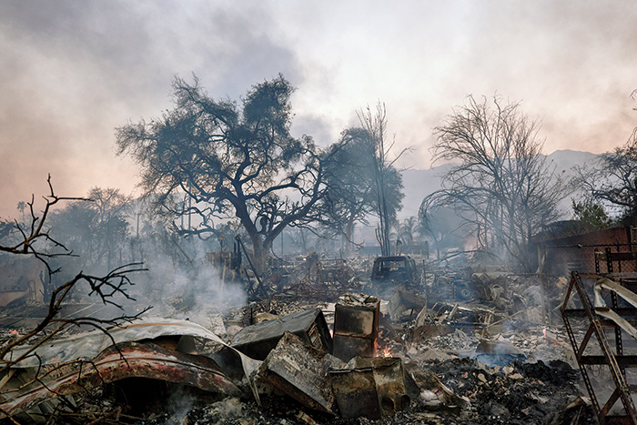
A home smolders in the 700 block of New York Drive in Altadena at 5 p.m. January 8 hours after the Eaton Fire swept through the neighborhood. Photo/by Jhovany Quiroz
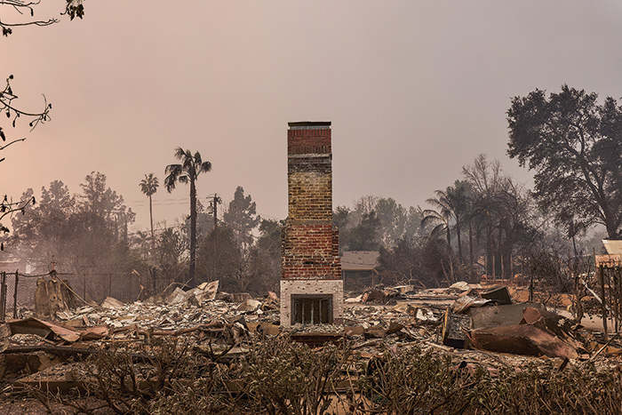
A chimney stands alone among smoldering rubble in Altadena at 2:13 p.m. January 8. Photo/by Jhovany Quiroz
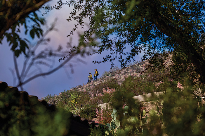
Cal-Fire firefighters survey a scarred hillside in the 2000 block of Liliano Drive in Sierra Madre at midday January 9. Photo/by Jhovany Quiroz
Homeowners affected by the wildfires may be eligible for property tax relief. More information is at boe.ca.gov/proptaxes/disaster-relief.htm.
The January 7 windstorm downed trees in Claremont on Foothill Boulevard, on College Avenue, Memorial Park, Lewis Park, June Vail Park, and on a handful of other streets. No injuries were reported.


0 Comments