

Bridge Fire explodes overnight; north Claremont under evacuation warning

The Bridge Fire as seen from western Pomona on Tuesday evening. Photo/by Alex McDonald
by Mick Rhodes | editor@claremont-courier.com
Residents in north Claremont around Fergus Falls and Mt. Baldy are under an evacuation warning and have been advised to prepare to evacuate. The Bridge Fire “continued to exhibit extreme fire behavior” overnight Tuesday, according to fire officials, burning some 13,000 acres and impacting structures in Wrightwood, including damage to the power infrastructure there. The fire had grown to 47,904 acres as of 9:30 a.m. Wednesday.
The fire grew mainly on the north and east flanks overnight. “The top priority for firefighters remained in structure protection and defense within the communities of Wrightwood, Pinon Hills and Mount Baldy,” according to a Wednesday morning update from U.S. Forest Service Angeles National Forest officials. “Once it is safe for damage assessment teams to evaluate, confirmed numbers will be released. Mountain High West and East Ski Resort were also affected by fire activity.”
The USFS will livestream its 10:30 a.m. press conference this morning on its Facebook page atfacebook.com/angelesnationalforest. The press conference will take place at the Santa Fe Dam boat launch 15501 Arrow Hwy., Irwindale, CA 91706.
The south end of the Bridge Fire jumped Glendora Ridge Road up to Sunset Peak, which was highly visible Tuesday evening from Claremont and surrounding foothill cities.
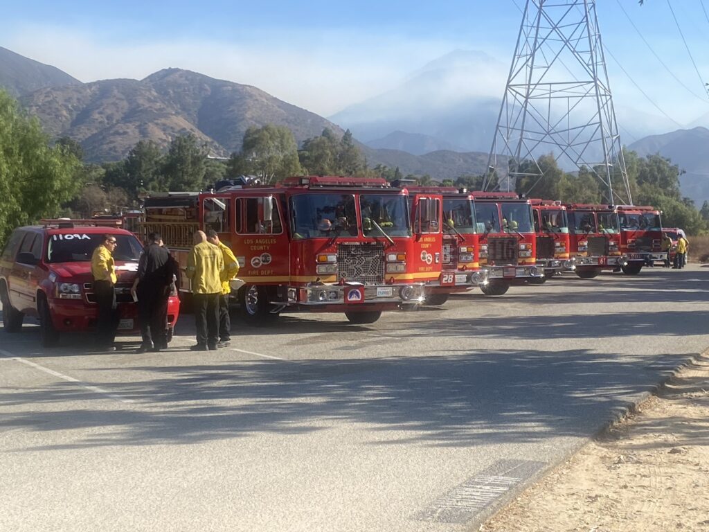
LA County Fire personnel talk strategy Wednesday morning at the Claremont Hills Wilderness Park parking lot, as several engines sit ready to be deployed to the Bridge Fire. Photo/by Megan Corning
“Despite the extreme fire behavior, lack of resources, and challenges firefighters had, they successfully defended homes, and no communication towers went down,” according to the USFS Angeles National Forest Wednesday morning update. “Firefighters held the lines they had west of Mount Baldy Road, and they continued to prioritize securing contingency lines to the south. By the public heeding evacuations, firefighters were able to get in and engage in the structure defense they needed to.
“As the fire continues to head into receptive fuels with little to no fire history, it could get established into drainages and have slope alignment, leading to the potential for large energy release that could create plume-driven fire behavior and column collapses which may send spot fires out ahead of the fire’s direction.”
San Antonio Heights and Upland from the foothills south to 23rd Street are under evacuation warnings.
Evacuation orders remain in effect for Mt. Baldy Road, all residents north of the San Antonio Dam up to the Mt. Baldy Resort; the entire community of Wrightwood; Pinion Hills from Wrightwood north to Highway 18 and Beekley Road west to LA County; Pinion Hills from Wrightwood north to Highway 138 and Lebec Road west to LA County; Lone Pine Canyon from Wrightwood to Hwy 138/Lone Pine Canyon Road south to the forest; and the East Fork communities of Camp Williams Resort and River Community.
About 500 firefighters are now battling the blaze.
For the latest updates on the fire, go to inciweb.wildfire.gov/incident-information/caanf-bridge-fire. Additional information, including some dramatic video, is posted on the Angeles National Forest Facebook page at facebook.com/angelesnationalforest.
The cause of the fire remains under investigation.
This story will be updated as more information becomes available.


0 Comments