

Fire safety: the forever topic

The Bridge Fire, seen here burning in the Angeles National Forest, scorched 56,030 acres in September 2024. Photo/courtesy of USFS
by Andrew Alonzo | aalonzo@claremont-courier.com
Fire safety has been an urgent topic in Claremont for as long as it has been a city. With a northern border extending into the foothills, talk of the wrath of wildfire is never far from the public square.
Claremont residents need only tap into their own recent history for a reminder: 2003’s Grand Prix Fire destroyed 65 homes in the City of Trees.
Claremont’s fire safety preparedness
Claremont spokesperson Bevin Handel said Claremont has a safety element within its general plan that addresses natural disasters like fire, and a local hazard mitigation plan, last updated in 2022, which includes mitigation measures and response plans to environmental events including wildfires. The latter is viewable at claremontca.gov, search “local hazard mitigation plan.”
That plan reads in part, “Wildfires are a natural part of the ecosystem in Southern California and present a substantial hazard to life and property in communities built within or adjacent to hillsides and mountainous areas … There is a huge potential for losses due to wildland/urban interface fires in Claremont. In urban areas, the effectiveness of fire protection efforts is based upon several factors, including the age of structures, efficiency of circulation routes that ultimately affect response times and availability of water resources to combat fires. In wildland areas, taking the proper precautions, such as the use of fire resistant building materials, a pro-active Fire Prevention inspection program, and the development of defensible space around structures where combustible vegetation is controlled, can protect developed lands from fires and, therefore, reduce the potential loss of life and property.”
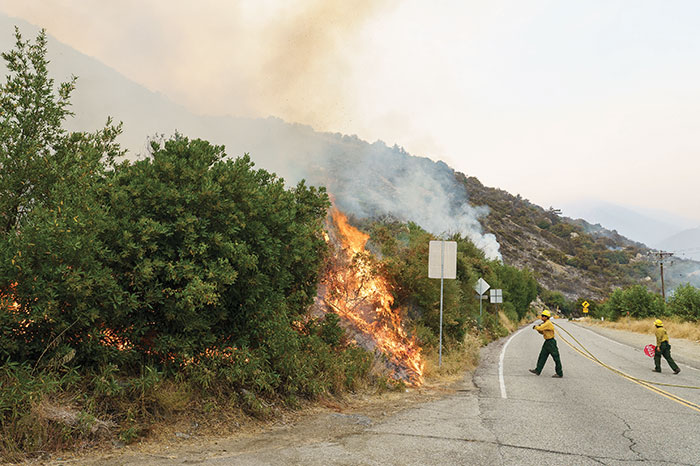
Los Angeles County Fire Department crews working on Mt. Baldy Road during the September 2024 Bridge Fire. Courier photo/Peter Weinberger
The Los Angeles County Fire Department staffs three fire stations in Claremont. The city defers to LA county fire, the U.S. Forest Service, and California Department of Forestry and Fire Protection, or Cal Fire, for handling brushfires.
County agencies are also tasked with ensuring brush clearance and inspections, checking building codes, and preparing resources for fire suppression.
Handel said the City of Claremont typically inspects and updates its plans for compliance with fire codes, clears city property of brush, including at the Claremont Hills Wilderness Park and trails, enforces evacuation orders set by the county and the state, and works with Southern California Edison and utility agencies during outages and public safety power shutoffs. The city also holds occasional fire safety workshops, trains community emergency response team volunteers, and coordinates with the state to stay fire ready.
Claremont Finance Director Jeremy Starkey described how the city funds its fire response initiatives.
“Claremont is part of the Los Angeles County Consolidated Fire Protection District, and receives fire services through the Los Angeles County Fire Department,” Starkey wrote in an email. “We have been part of the District for decades, and the district is funded directly through County property taxes. Since the City does not pay the County for these services, there is no need to include funding in our budget.”
In July, Claremont City Council adopted it latest fire hazard severity zone map. The map was mandated by the state and created by Cal Fire and distinguishes moderate, high and very high fire zones.
“These maps identify varying levels of fire hazard- Moderate, High, and Very High – based on factors including vegetation, topography, weather, crown fire potential, and ember production and movement,” read a Claremont city staff report. “CAL FIRE uses a fire hazard severity model for wildland fire that has two key elements: probability of an area burning and expected fire behavior under extreme fuel and weather conditions.”
Much of Claremont’s fire hot spots lie north of the 210 Freeway where 288 acres were noted as moderate, 954 as high, and 3,188 as very high at the July 22 City Council meeting. By contrast, the 2011 map listed 4,158 acres in the very high zone.
“These maps are used to guide building standards for new construction in the wildland-urban interface,” in addition to “property development standards such as road widths, water supply, signage, and defensible space requirements,” city analyst Alex Cousins said at the July 22 meeting. “So this includes clearing brush and vegetation surrounding buildings and maintaining spacing between trees and shrubs.”
Claremont Vice Mayor Jennifer Stark remembers evacuating her home on Alamosa Drive during the 2003 Grand Prix Fire. She said that experience has guided her actions on fire safety and protection practices. And as chair of the city’s newly established emergency preparedness ad hoc committee, Stark has heard fire safety concerns from citizens over the last few months in the aftermath of the Eaton Fire.
Stark said recent concerns have included the potential of trees as fire fuel.
“I think that what is really, really important is that we need to make decisions that are based on science and best practices, and weighing the benefits of living in a well landscaped and beautiful city to the fact that if there were a fire, there’s more fuel,” Stark said. “What we do want to make sure that we have is, again, all the preparation in place so that we are able to protect human life and property to the very best of our ability, and to make sure that people are moved into safety efficiently, effectively, and that the people who are most vulnerable are also considered in these plans.”
Stark commended Claremont’s ongoing fuel mitigation practices and said the city will learn a lot from its county fire partners as it navigates it updated fire severity zones.
“The fire department is going to start noticing homes in the very high severity zones about needing to harden their homes,” Stark said. “Also, as part of the ad hoc committee, I hope one of our deliverables will be some really useful tool kits for our homes that are in that very high, severity zone. By that I mean offer a very good pathway to learning more about what homeowners need to do to make their home safe and compliant with the new standards.”
Homeowners should inquire with their insurance provider about rebates for costs associated with fire hardening their dwellings.
Stark said “fire breaks” — natural or human-made barriers that slow fires, such as the 210 Freeway — may not be viable in the long term given the area’s weather conditions.
“We are also very vulnerable to a devastating fire in a windstorm,” Stark said. “What we have historically thought of as fire breaks no longer are fire breaks, namely the freeway and the highway.”
Fire preparedness is key, according to Handel, including creating an emergency plan, preparing ahead for evacuation, and fire hardening your home.
Search “fire prevention,” “emergency management,” and the “local hazard mitigation plan” at claremontca.gov to learn about local fire regulations and strategies for prevention and preparedness.


0 Comments