

Vista Fire continues to threaten Mt. Baldy Resort

A helicopter douses the Vista Fire with a load of water on Monday. Photo/courtesy of Mt. Baldy Resort
by Mick Rhodes | editor@claremont-courier.com
The stubborn Vista Fire, burning since Sunday in the San Bernardino National Forest between Lytle Creek and Mt. Baldy Resort, remained 0% contained at press time Thursday, but officials say they hope to make some progress in that statistic soon.
“Not yet, but we’re hoping to get some [containment] by tonight,” U.S. Forest Service Spokesperson Nathan Judy said at 11 a.m. Thursday. “We have a good black line up on the Backbone Trail.” A “black line” is a trench dug to bare mineral soil to cut a line between the unburned fuel and the fuel that’s burning, Judy explained.
The fire grew from 588 acres Sunday to 1,095 on Monday, more than doubled in size to 2,354 acres on Wednesday, and by Thursday had scorched 2,700 acres. The blaze began Sunday above Lytle Creek. The cause is still under investigation. “We don’t guess,” Judy said when asked about the source of the blaze.
On Sunday the Forest Service evacuated some 200 hikers and campers in the Lytle Creek area and about 100 more near Mt. Baldy Resort.
No injuries to firefighters or civilians had been reported as of press time. And though no structures had been damaged or destroyed, the fire continues to threaten buildings on both sides of the mountain.
The fire “is bumping up against the Mt. Baldy Resort,” Judy said. “That area is a ski area as well, so that has a lot of open terrain with not a lot of fuel … so there is some grass in that area, but really the back side of that down into Lytle Creek has some thicker brush and some timber components up toward the top, towards Mt. Baldy, and that’s where the fire’s been burning.”
The Vista Fire has also created harmful air pollution in Claremont and surrounding communities, with the Air Quality Index in the city reaching 206 — or “very unhealthy” — at 5 p.m. Wednesday, according to airnow.gov. The only AQI level above very unhealthy is “hazardous.”
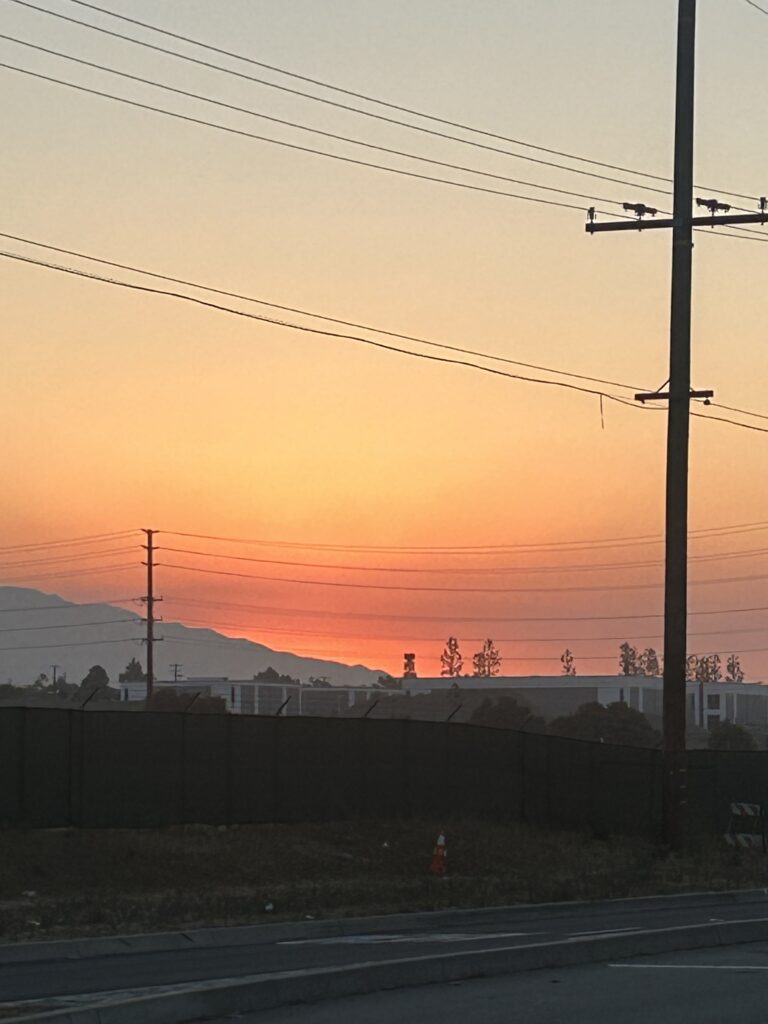
Arrow Route just east of Claremont Boulevard at dawn on July 8, showing the heavy smoke from the nearby Vista Fire. Photo/by Char Miller
More than 360 firefighters and other personnel are working to contain the fire. The fight includes several air tanker planes, which fly only during daylight hours, and Cal Fire helicopters, which fly day and night. “Overnight we had what we call a quick reaction force,” Judy told the Courier Wednesday. “Those are two heavy helicopters. Last night they were able to drop 60,000 gallons worth of water to cool the fire itself. Those aircraft will continue to work overnight on this fire.”
The U.S. Forest Service is in “unified command” with the San Bernardino County Fire Department. Other cooperating agencies include fire personnel from the Angeles National Forest, the California Highway Patrol, and the San Bernardino County Sheriff’s Department.
“We have firefighters from all over the state that are down here helping us out,” said Judy. “We have everything from aircraft to hand crews, to [bulldozers], and of course our fire engines.”
Winds have been “light and variable” since the fire began Sunday and they nor humidity have not been a significant factor in its spread, Judy said. “Usually in the daytime the wind will want to go uphill. At nighttime it shifts and goes back downhill,” Judy said on Wednesday. “So we saw a push downhill last night … not directly towards Lytle Creek, but back down the mountain. It pushed back toward Stoddard Flats last night,” away from Mt. Baldy Resort.
The fire did come within a mile of Mt. Baldy Resort early Wednesday, bumping up against the Backbone Trail. “But because that’s a trail and it’s well defined and people walk on it all the time, there’s no vegetation. So it acted as a good fire break,” Judy said.
The fire established itself in Coldwater Canyon on Monday and made some significant runs up toward Mt. Baldy Resort, Judy said.
“It didn’t get there just yet,” Judy said. “So we are having a unified command with San Bernardino County Fire. Their folks are up in the Mt. Baldy community doing structure protection up in the resort itself. We also have firefighters up there monitoring the fire in case it does turn into that area. They’ll be up there to protect the [area].”
In order for the USFS to call a fire contained in any way, a “black line” must be established around it, either by bulldozer or specially trained Hot Shot crews, both of which dig in the dirt down to bare mineral soil to establish a barrier between the advancing fire and unburned fuel. Hot Shot crews use hand tools only and no water, and with the steep, rugged terrain of the Vista Fire it’s been a challenge to establish a line. The same goes for bulldozers, which are unable to navigate much of the forbidding landscape.
“Because this is steep and rugged terrain, it’s hard for our crews to get in there. It’s like going straight up the side of a hill in some places,” Judy said. “So even if we cut so much line on this fire, until we are convinced that it’s not going to jump over that, we’re not going to call it contained. It could take some time for us to get some containment just because of the terrain that we’re in.”
Mt. Baldy Road remained open Thursday, but access to the area from Lytle Creek Road was closed to all but residents.
Judy stopped short of saying there was an imminent threat to the Mt. Baldy Resort. “It’s still under threat, but you’re not looking at the fire running up there and burning everything down; no, nothing like that.”
There are no plans to evacuate Mt. Baldy Village residents. “We’ll continue to monitor the area,” Judy said. “We work closely with the San Bernardino County Sheriff’s Department, so in case evacuations were necessary we work with those folks … the sheriff’s department is actually the [agency] that would make evacuation notice decisions.”
As far as the many wildlife species who call the area home, Judy said all was well as far as he could tell. “Wildlife, they’re pretty smart,” he said. “They know when there’s a fire in the area and they evacuate themselves. We haven’t had any reports of injured animals.”
For the latest updates on the fire, Judy recommended visiting the federal incident information management system website, inciweb.wildfire.gov, or the San Bernardino National Forest Facebook page at facebook.com/sanbernardinonf. For air quality information, go to airnow.gov.


0 Comments