
Snow in Claremont? It’s possible!

by Mick Rhodes | editor@claremont-courier.com
An unusually cold and windy winter storm is poised to envelop Claremont and the rest of Southern California this weekend, bringing with it possible snowfall in foothill communities and dangerously high surf along the coast.
The National Weather Service predicts snow levels to fall as low as 1,500 feet through Thursday morning. Claremont is 1,169 feet above sea level. So, if conditions worsen we could see snow accumulating in Claremont for the first time since about 1972.
“You’re pretty close to the edge of the rain/snow line,” said Kristen Stewart, a meteorologist at the National Weather Service’s Oxnard office.
Possible snowfall in Claremont isn’t the only rare component to this storm. The unusually cold front, which originated in British Columbia, brings with it unusually high winds, prompting the NWS to issue — for the first time in at least 40 years — blizzard warnings for Angeles Forest mountain communities such as Mt. Baldy on up through the Santa Barbara Mountains.
“Looking back into our history, we are not aware of any blizzard warnings that we’ve issued in the past,” Stewart said. “We went through [40 years of] our archives and we couldn’t find anything. Usually we don’t get super significant really heavy snow combined with strong winds at the same time. It’s pretty uncommon.”
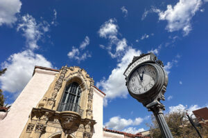
Calm before the storm: clouds moving in over the Claremont Depot Wednesday. Courier photo/Peter Weinberger
Regardless of what form our precipitation takes, there will be a lot of it. Stewart said Claremont could see between two and six inches of rain over the weekend.
“Since you’re right at the foothills that’s kind of like the perfect sweet spot for enhanced rainfall,” Stewart said.
The Wednesday and Thursday portion of the storm is bringing very cold air, but as it drops down to the south Thursday and the second wave of the storm arrives Friday, it will be buffeted by a shift in warmer airflow from the south, Stewart explained, causing freezing temperatures to rise to higher elevations.
Stewart warned people to stay away from Mt. Baldy at all costs.
“Mt. Baldy is notorious for being a pretty dangerous spot during winter storms, with a history of avalanches and things like that,” she said. “I can see some avalanche conditions being possible [during this storm] with some pretty heavy snow up there.”
Stewart also cautioned against traveling both in the flatlands and mountain areas.
“It’s going to be pretty treacherous travel conditions everywhere,” she said, adding road closures are likely in mountain areas. “So, even if you want to go skiing up in Big Bear or someplace like that, it is not advised to travel until conditions are improved after this storm ends.”
Stewart said major precipitation should abate by Saturday night.
But keep those raincoats handy: another strong winter storm is lining up now, due to hit Southern California Monday or Tuesday, Stewart said.


0 Comments